
Site is in development off and on. Link buttons with white backgrounds haven't been completed. Colored buttons should work. Please let me know if you encounter a broken link. Comments and suggestions welcome
Zhartas
A Neolithic and Eneolithic Stone Quarry near Kokshetau, Kazakhstan
Bruce Bradley, Sandra Olsen, Shagban Bektasov, Eva Hulse
Introduction
Recent years have seen great advances in the archaeology of the Eneolithic in Northern Kazakhstan. It is apparent from the two main sites, Botai and Krasnyi Yar, that flaking stone was a major resource. Efforts to identify and locate stone sources, have been unsuccessful, with a single exception. Last summer during survey partly funded by the National Science Foundation, we discovered a source of stone used during the Neolithic and Eneolithic, not far from Krasnyi Yar . This was not an accidental discovery. Excavations at the Eneolithic site of Krasnyi Yar in 2000 and work at the Neolithic site of Zhusahn in 2001 yielded many flaked stone artifacts, of at least five different origins. To that point, none of the sources of this stone were known.
During analysis, Bradley noted a distinctive silicified siltstone as the dominant material in an outside flaking area adjacent to the excavated house at Krasnyi Yar. Although most of this material is dark red, gray and green varieties are present. It was also apparent that some of the material was being brought to the site in relatively unmodified pieces, based on the common occurrence of cortex flakes. Our conclusion was that there was probably a nearby source, but discussions with local archaeologists and examination of local survey reports did not prove fruitful.

Zhartas location
Survey
Two incidents led to the successful discovery of the source of siltstone. The first was Bradley noted that some of the road material used in the village of Krasnyi Yar closely resembled the sought after siltstone, except that it was unsilicified. During a hike, Bradley and associate Alan Outram found a small road, topped with crushed red siltstone, leading into an abandoned industrial plant. Careful searching in the road yielded one small piece of flakable material. The hunt was on. We concluded that this road material must have come from a nearby source. Again, questions to locals did not reveal a source. One day, not long afterward, Bradley spotted a modern quarry on a hill side just south of the road from Kokshetau to the small village of Sadovaya. The color, from the distance, was dark red.
It was a couple of weeks before there was time to investigate the hill. Then, Bradley accompanied Hulse and her survey crew, examined the suspect area. A short walk up the hill, to the south of the highway, was enough to reveal an extensive modern quarry area. It was clear from the deposits of dark red siltstone that we had found where the road material had been obtained. Modern quarrying had clearly not taken place for quite some time because much of the pit area was covered with a stand of two to four meter high pine trees. Further survey up the hill, above the level of the modern quarry, soon encountered a wide scatter of flaked stone artifacts, mostly made from green silicified siltstone. Reconnaissance indicated a wide scatter of artifacts and some very suspicious shallow depressions encircling the north side of the hill top.
We returned at a later date and systematically examined the hill top and the surrounding hills. It became clear that the shallow depressions were filled-in, ancient, quarry pits. Each pit was mapped using a Global Positioning Survey meter and the coordinates recorded. Estimates of the original pit area, pit form, and the color of the associated artifacts were noted. We also identified the edge of the quarry site by taking G.P.S. readings where surface artifact density dropped to zero per 100 m2.

Zhartas site plan
The Quarry
Systematic survey resulted in the location of 31 probable prehistoric quarry pits site map. Some of these were isolated while others seemed to be in lineal alignments. Each pit is represented by a shallow depression into the side of the hill with a flattened to slightly mounded area on the downhill side, a quarry spoil pile. A few pits were partially covered by later, higher spoil piles, and it is quite possible that we missed some pits that are completely obscured.
The majority of pits are located on the north side of the hill, in a wide ridge, just below the hill top. These pits are associated with green siltstone artifacts and unworked pieces. Another pit cluster is located along a north-facing hill slope to the west of the hilltop, and the materials around these pits were also green siltstone. No pits were noted on the hilltop but artifact density continued, and may even have become denser. There is a mix of dark red, gray, and green artifacts on top. Two distinct pits are present on the southeast side of the hill, and both of these are associated with gray stone. Curiously, none of the pits were associated with the dark red material typical of the Krasnyi Yar collections. Subsequent expansion of the survey area located a single quarry pit on a lower hill slope to the southwest (not on this map), which was clearly cut into a red stone source. Expanded survey onto surrounding hills located a wide, light scatter of siltstone artifacts, but no more quarry pits. We named this site after the Kazakh word for rocky hill, Zhartas.


Zhartas artifacts
Artifacts
Time for work at Zhartas was limited so no attempt was made to recover a large collection of artifacts or to do in-field analysis. We did map and recorded nine pieces that we used to determine the time period(s) the quarry was in use. One shaped pieces (artifact a) is probably a precore intended for the production of small blades. It has been shaped to have a sharp central ridge below a platform surface. This would have served as a projection for the removal of the first (corner) blade. The second artifact is just such a core where the first guide blade has been removed (artifact b). From this stage, it would have been possible to begin making usable blades. The third core (artifact c) has blade scars that indicate pressure blade removal, but the last one ended in a deep step fracture, making subsequent blade removals impossible without significant reflaking of the core surface.
One artifact is a thick, curved corner blade (artifact d) that looks like it was probably the first taken from a small blade core. This blade probably served as a guide for subsequent blade removals. We also encountered the distal fragment of a pressure blade (artifact e) that came from a core that was further along in the production sequence than the cores we found. This may indicate that blade production at the site progressed past the initial stages. All of these artifacts indicate pressure blade manufacture consistent with Neolithic technology, such as that seen in the Zhusahn assemblage. Four pressure blades or fragments made from siltstone were found at Zhusahn. All of them could have been produced from the types of cores recovered at Zhartas. Two of the siltstone blades from Zhusahn are red, one is gray, and one is green.
Biface technology is also represented at Zhartas. We recorded two small bifaces (artifacts f-g). One is quite irregular and it is unclear if it was intended to be a bifacial tool or was just the remnant of a quarry blank. The other is a typical small biface, made by percussion flaking. Several were found like it at Krasnyi Yar, including two stashed together under the floor of the house. Of the 57 bifaces recovered from Krasnyi Yar, 10 (18%) were made of Zhartas siltstone. All but one is a variety of red with the single exception being gray. It seems clear that Zhartas was being used as a source of material for biface manufacture during the Eneolithic. We also observed a single flake of siltstone, probably from Zhartas, at the other large Eneolithic site, Vasilkovka, in the Kokshetau area. A single specimen does not mean much on its own, but it makes up a significant proportion of the less than 20 flakes we saw there.
Finally, we noted two other artifacts at Zhartas. One (artifact h) is a rounded cylinder-shaped piece of sandstone. It is shaped on all of its surfaces and may have served as an abrader, possibly for platform grinding during a flaking process. The last artifact is a fragment of a dark red siltstone peckingstone. Battering of high points suggest that this implement was probably used, at least initially, to shape other stones by pecking, rather than being used as a flaking hammer. Once the projections were battered down, it could then have been used as a flaking hammerstone. Either way, it probably served a use during quarrying.
Geology
We have had little success in identifying the geological origin of the Zhartas siltstone. It occurs in a line of hills that extend west from Kokshetau. We examined all of the hills from Kokshetau as far west as an area known as Electi. No other occurrences of the siltstone were located. A surface geology map shows the area of the Zhartas quarry as being a small intrusion/uplift of Cambrian age. It also indicates the presence of a flinty material. A small road cut downhill to the south of the quarry, shows a highly fractured, uplifted bed of siltstone. In this location, the siltstone is not silicified. We are unsure why some of this larger siltstone deposit was silicified. Focused geological study is needed to understand what process formed this flakable variety of stone.
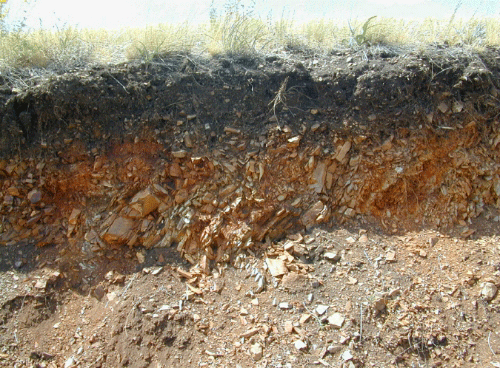
Road cut
Conclusions
Archaeological evidence coupled with observation of road bed materials led us to the discovery of a source of stone used both at the Neolithic site of Zhusahn and the Eneolithic site of Krasnyi Yar. Close examination of the source revealed that it was exploited through the use of quarry pits. Artifacts found on the surface of the quarry reflect technologies consistent with both Neolithic and Eneolithic flaked stone technologies in the Kokshetau area. It is no surprise that the material was used at the nearby sites of Zhusahn and Krasnyi Yar. Indeed, if anything, it is surprising that it doesn't make up a much higher proportion of the site assemblages than it does.
The recording of the Zhartas quarry is only the first step in the location of all of the sources of stone used during the Neolithic and Eneolithic of the area. Surface examination is inadequate to really evaluate what was taking place and who was doing the quarrying at Zhartas. Since flaked stone makes up the great majority of artifacts found at Neolithic and Eneolithic sites, knowing the sources of the stones is critically important to the understanding of the economies, interactions, and territorial uses of each time period. The almost complete change in flaked stone technology between the Neolithic and Eneolithic in the Kokshetau area may indicate a population replacement, but is this also reflected in changing flaked stone source use? It is clear that focused effort is needed to identify additional sources to examine the relationships between resource exploitation, mobility, and regional interaction.